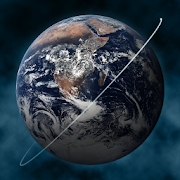
Earth-Now
NASA's Earth Now is an application that visualizes recent global climate data from Earth Science satellites, including surface air temperature, carbon dioxide, carbon monoxide, ozone, and water vapor as well as gravity and sea level variations. Data sets are visually described using "false color" maps. Color-coded legends are provided to indicate relative strength or weakness of an environmental condition. The resulting 3D model of the Earth may be rotated by a single finger stroke, and may also be zoomed in or out by pinching 2 fingers. It was developed by the Earth Science Communications and Visualization Technology Applications and Development Teams at NASA's Jet Propulsion Laboratory, with support from NASA Headquarters.
來自NASA的地球科學衛星的3D可視化近期的全球氣候數據
NASA的地球現在是從可視化地球科學衛星最近的全球氣候數據,包括氣溫,二氧化碳,一氧化碳,臭氧和水蒸汽,以及重力和海平面變化的應用程序。數據集使用的是“假色”的地圖可視化描述。提供顏色編碼的傳說來表示相對強度或環境條件的弱點。地球的所得到的三維模型可以通過單個手指衝程旋轉,並且還可以放大或縮小由夾持2個手指。它是由地球科學通信和可視化技術的應用和開發團隊在美國宇航局噴氣推進實驗室開發的,由美國航空航天局總部的支持。